New and Used Car Talk Reviews Hot Cars Comparison Automotive Community

The Largest Car Forum in the Philippines

Page 25 of 76 FirstFirst ... 152122232425262728293575 ... LastLast
Results 241 to 250 of 758
  1. Join Date
    Jul 2008
    Posts
    131
    #241
    Quote Originally Posted by ghosthunter View Post
    GPS service is available (since it is based on many geostationary satellites orbiting the planet) but depends on your device/software if they have a map for the Philippines.

    For now, I doubt if you can find a GPS navigation system as an option to a new car. Best you can do is a portable unit like the TomTom or even Nokia N95 or 6110-Navigator. A bit more pricey but if you already have a laptop computer, you can get a GPS antenna and software.

    "based on many geostationary satellites orbiting the planet" : Sir, for your info when we say GEOSTATIONARY that means it isn't ORBITING. The GPS system used by cars and land vehicles is the same technology that we, here onboard ships, use. An array of 39 satellites at specific geostationary positions at a height of about 7.5 km to 10 km altitude, follow the earth's rotation and covers the whole earth from pole to pole. They do not ORBIT as the chances of collision is very high.

    In the US, Harbour pilots (They guide the ships when going in and out of ports) use Laptops with GPS software, ECDIS and AIS interface. The whole ensemble cost them US$10k to US$20K (depende sa software). TomTom na lang mas mura.

    Kung within Metro-Manila ka lang, why use a GPS? Out of town, okey lang lalo't first time ka sa puntahan mo ( like sa Sorsogon o Cotabato ).
    I normanlly stay out of the country for 6-9 months per year and every year may pagbabago sa Metro-Manila, yet I still don't see the need for a GPS to get me around town.

  2. Join Date
    Sep 2005
    Posts
    1,218
    #242
    Quote Originally Posted by ChevyChaser
    "based on many geostationary satellites orbiting the planet" : Sir, for your info when we say GEOSTATIONARY that means it isn't ORBITING. The GPS system used by cars and land vehicles is the same technology that we, here onboard ships, use. An array of 39 satellites at specific geostationary positions at a height of about 7.5 km to 10 km altitude, follow the earth's rotation and covers the whole earth from pole to pole. They do not ORBIT as the chances of collision is very high.
    I'm sure ghosthunter meant "orbiting" ...

    But GPS satellites DO ORBIT the planet. The only geostationary satellites for GPS use are 4 SBAS (Satellite-Based Augmentation System) satellites. The mere fact that the received signal strength varies without any disturbance on the receiver on a clear sunny day indicates that the sats are moving.

    Here's a 2D visual of the orbits from a satellite-tracking software:


    It's interesting to note that the telemetry/orbital data available for downloading are only for 31 GPS satellites. But AFAIK, there are only 24 active GPS and the rest are on standby as reserves (here's the math: 6 orbital planes with 4 satellites each = 24). It's not like the very first batch of GPS satellites are all still around and still operational (Group I, with 11 sats launched between 1978-1985) ... hence the reserve. The US have to launch new ones in anticipation of older ones going kaput - the most recent batch I think being Group IIR.

    Also, if you read about telemetry, tracking and control, you'll find out that the chance of a collision between GPS satellites is practically nil. There's a reason why smart people are often called "rocket scientists" ... there's tons of number-crunching to be done before you put a bird up in orbit.
    Last edited by StraightSix; August 3rd, 2008 at 05:38 AM.

  3. Join Date
    Apr 2006
    Posts
    894
    #243
    agree they do orbit. if you're (or ship is) stationary, go to your "skyplot" on your GPS receiver and you will see that the satellites you track "rise" and "set".

    yes, the necessity isn't that high and I doubt if the maps available for the philippines have route calculations imbeded as well (which I think would need to be updated very often given the frequency of changes in our traffic schemes). but then, to some it might be more easier to plan your route (like when using google earth) compared to holding a map book like the "Metro Manila Atlas" or "The Heart of Metro Manila", etc.

    and ofcourse, at times, bragging rights... you know, "hey I've got the latest gadget".

    oh, and some are "hobbyists" like the guys at waypointsdotph.

    .02

  4. Join Date
    Aug 2008
    Posts
    5
    #244
    Quote Originally Posted by StraightSix View Post
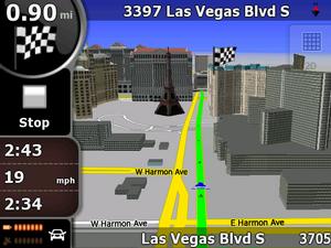
    I love this navigation software. It's the same navigation software you'll find on the iPhone, iPod Touch, Asus navigators and Sony PSP (as GO! Explore).


    Walang sinabi ang Garmin Mobile XT at Tomtom Navigator.

    Unfortunately, the PDA version is memory-hungry. With a minimum requirement of 64MB RAM and 128MB ROM, I expected it to run on either of my PDA's, the XDA Exec (HTC Universal) or XDA Orbit (HTC P3300). But it just kept on crashing, running out of memory. I uninstalled every application that I can and used a memory manager ... but still no luck.

    It is still usable ... but without the Text-To-Speech and 3D rendering. Even so, a long route like a 100-mile trip to London sometimes result in an Out-Of-Memory error even in simulation. But without 3D and TTS, its not different anymore from Garmin or Tomtom.
    i just bought Asus R300 GPS, meron po bang map ng philippines na pwede i load d2? it comes with 2GB SD card kaya lng di ko alam kung paano mag load. thanks!

  5. Join Date
    Aug 2008
    Posts
    5
    #245
    Quote Originally Posted by StraightSix View Post
    I love this navigation software. It's the same navigation software you'll find on the iPhone, iPod Touch, Asus navigators and Sony PSP (as GO! Explore).


    Walang sinabi ang Garmin Mobile XT at Tomtom Navigator.

    Unfortunately, the PDA version is memory-hungry. With a minimum requirement of 64MB RAM and 128MB ROM, I expected it to run on either of my PDA's, the XDA Exec (HTC Universal) or XDA Orbit (HTC P3300). But it just kept on crashing, running out of memory. I uninstalled every application that I can and used a memory manager ... but still no luck.

    It is still usable ... but without the Text-To-Speech and 3D rendering. Even so, a long route like a 100-mile trip to London sometimes result in an Out-Of-Memory error even in simulation. But without 3D and TTS, its not different anymore from Garmin or Tomtom.
    i just bought Asus R300 GPS, meron po bang map ng philippines na pwede i load d2? it comes with 2GB SD card kaya lng di ko alam kung paano mag load. thanks!

  6. Join Date
    Aug 2008
    Posts
    5
    #246
    Quote Originally Posted by raptormnl View Post
    Just follow the instructions below -

    1. Install MapSource on your computer. Note that the disk is DVD and not a CD.
    2. Download the 5.00 Beta version of the maps from the site - http://www.freewebs.com/phroadguide/index.htm

    3. Run the exe progam that you downloaded. This will install the maps in your MapSource.
    4. Open MapSource. In the drop down list of the the maps, select Phillipines Routable v5.00 Beta.
    5. Using the Map select tool, highlight the map segments (or all of them) that you want to load to your GPS unit.
    6. Connect your GPS unit to your computer with the USB cable.
    7. Click the Send to Device button in MapSource.
    8. When the Send to Device dialog box comes up, select your GPS unit or your SD card as the destination.
    9. Be sure the Maps check box is checked.
    10. Click Send.
    11. Clik Ok when MapSource is done sending the maps.
    12. Disconnect your GPS unit from your computer.
    13. Once the unit boots up, check to be sure the maps are selected. Wrench/Settings > Map > Map Info
    14. Pan and browse the map to the area where the maps are located. You should see the outline boxes of the map segments.
    15. Zoom in.
    hi, the latest Mapsource in Garmin website is 6.14.1, mag work kaya ito? if not, pwede po ba makahingi sa may copy ng 6.13.6 or 7? thanks!

  7. Join Date
    Sep 2005
    Posts
    1,218
    #247
    Quote Originally Posted by B2Bomber View Post
    Hehe. Di rin ako familiar kuya. ngayon ngayon pa lang ako nagtitingintingin sa mga topics regarding Navigation as an enthusiast/hobbyist... para naman di nakakahiyang sa positioning/navigation tayo pos wala tayong kaalam-alam sa nav scene sa homeland. hehe.
    actually, nahanap ko yung link sa favorites dito sa net pc namin, pero di ko na maload. anyway, nadownload ko naman yung 2 downloadables nila e. yung isa e alleged tried and tested na pang-garmin, yung isa beta test na pang-garmin. gusto mo swap tayo nung map mo? hehe. medyo malaki-laki nga lang 'tong mga file, <10mb yung pinakamalaki.
    speaking of phone navs, any idea which bluetooth capable gps receiver (apart from Nokia's) can the E90 work with? TIA.
    Sowee ... ngayon ko lang nabasa itong post mo. For some reason the e-mail notification to post replies has stopped working on my tsikot account, so sometimes I miss reading questions such as yours.

    Carlos' map of the Philippines (for Garmin's) is a bit over 7 MB, while the freewebs map is a bit over 14 MB. Both maps are free, and I already have a copy of both. Is that a different map?

    ---

    I don't think you'll have any problem regarding Bluetooth compatibility with Nokia's. I've had v2 and older Bluetooth GPS receivers and they've worked OK with all the Nokia phones we've had, old and new. The E90 shares the same OS, UI and BT specs with the N95. I've used the Tomtom navigation software on the N95 and it worked with all the (external) Bluetooth receivers I've had.

  8. Join Date
    Sep 2005
    Posts
    1,218
    #248
    Quote Originally Posted by chee4869f View Post
    i just bought Asus R300 GPS, meron po bang map ng philippines na pwede i load d2? it comes with 2GB SD card kaya lng di ko alam kung paano mag load. thanks!
    I'm not aware of any. Unless you find a way to get another navigation software (with a Philippine map) that works with the R300. Or wait for Asus/TeleAtlas to come out with one for the R300.

  9. Join Date
    Feb 2007
    Posts
    2
    #249
    I use Tomtom One here in Illinois.

  10. Join Date
    Oct 2005
    Posts
    25
    #250
    Sirs! I am a few clicks from purchasing a garmin 660 from amazon. I just need an assurance that I will be able to use it here in the Phils. USD299 is a lot of money to waste kung sakali hindi ko magagamit ang locally available map/s.

    Is this purchase OK?

Tags for this Thread

GPS Navigation System [merged threads]