Results 5,341 to 5,350 of 11478
-
October 16th, 2015 01:05 PM #5341
-
October 16th, 2015 01:25 PM #5342
Wondering why the forecast show the storm strength won't be affected too much by the Sierra Madre mountain ranges and why it will take the storm 3 days to cross Luzon... that's what people are worried about. Only good thing is it will pass over the water sheds that need the rain.
Last edited by Monseratto; October 16th, 2015 at 01:33 PM.
-
October 16th, 2015 01:25 PM #5343
+++++++++++++++++++++++++++++
Last edited by Monseratto; October 16th, 2015 at 01:33 PM.
-
 BANNED BANNED BANNED

- Join Date
- Sep 2014
- Posts
- 8,492
-
 Tsikoteer

- Join Date
- Aug 2003
- Posts
- 9,720
October 16th, 2015 01:33 PM #5345i read a tweet that Lando is bring several feet of rain. Are we talking about Ondoy-level rains here?
-
 BANNED BANNED BANNED

- Join Date
- Sep 2014
- Posts
- 8,492
October 16th, 2015 01:38 PM #5346Malang Ondoy level kase hindi naman gano umulan since June. Nature has to correct the imbalance
-
October 16th, 2015 04:04 PM #5347
-
 BANNED BANNED BANNED

- Join Date
- Jan 2015
- Posts
- 4,580
October 16th, 2015 04:10 PM #5348
-
October 16th, 2015 04:30 PM #5349
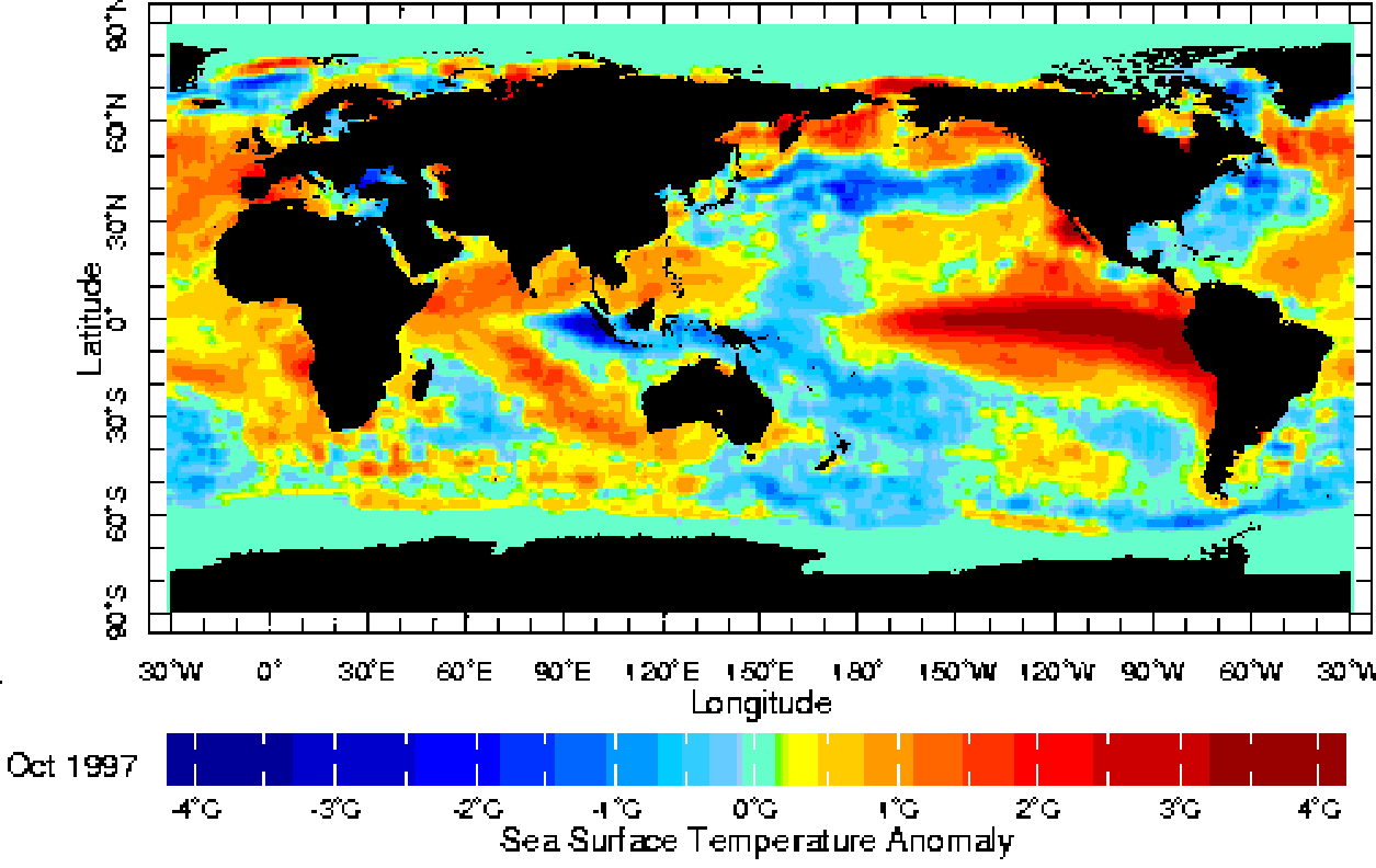
El Nino is a warm(er) water current. Typhoon development normally start off the coastal waters of western South America in the same way hurricane development start off the west coast of Africa. Look where that El Nino current is located. Right smack where typhoons first start to develop.
Droughts? That is normally caused by something else.
Edit:
The tropical systems start out as tropical waves. Depending on atmospheric conditions very high up, there may be a Tropical Upper Tropospheric Trough (TUTT) present above the path the tropical waves take. If a tropical wave passes underneath a TUTT, there's a good chance the tropical wave will intensify into a depression/storm/typhoon. With an El Nino year, there is normally an increase in the formation of tropical waves.Last edited by Jun aka Pekto; October 16th, 2015 at 05:10 PM.
-
October 16th, 2015 06:31 PM #5350


 Reply With Quote


![Google Play Weather TALK [forecasts, etc]](https://play.google.com/intl/en_us/badges/images/generic/en_badge_web_generic.png)
Cons, masarap sa mga daga.
BYD Philippines