


Yahoo 🙌🙌🙌 sa wakas nailabas din. Sarap i drive pero butas yun bulsa. Sir Djerms nauwi rin sa 3.0 la na kasi 2.5 na silver.Originally Posted by Djerms

Si Djerms dba kasama karin sa dieselclub nung mga time na nag EB sa dfort.
The Largest Car Forum in the Philippines
- Forums
- Discussions
- Events
- Community
Results 3,081 to 3,100 of 12125
Hybrid View
-

 Tsikot Member Rank 4

- Join Date
- Nov 2002
- Posts
- 1,515
November 24th, 2015 07:47 PM #1Last edited by x-wind; November 24th, 2015 at 07:49 PM.
-
 Verified Tsikot Member
- Join Date
- Oct 2015
- Posts
- 733
November 23rd, 2015 07:13 PM #2Bro I think you mean losing control when hydroplaning? Hydroplaning is inevitable when a car is traveling at a high rate of speed over a puddle of water and the tires lose contact to the ground. Originally Posted by Newcomer123
4x4 is best with front and rear lockers, LSD helps a bit, but lockers always gets the job done. Trust me, i do offroad. ;)
The TCS system of the MU-X interferes with the braking system at the rear to keep traction at bay. You can't do donuts or burnouts when it is activated as it will stop the wheel from turning faster than it should. I think the reason why it is only available on the automatic variants is to avoid accidental powerslides while turning over a wet surface. It is easy to do it on the MU-X or any other PPV/Pickup without TCS.
-
Verified Tsikot Member
- Join Date
- May 2008
- Posts
- 20
November 23rd, 2015 11:26 PM #3Thank you Sirs. These are all very informative. Learning a lot. Originally Posted by aar0nix
-
Verified Tsikot Member
- Join Date
- May 2006
- Posts
- 391
November 24th, 2015 12:01 AM #4Help naman sa gumagamit ng navi.. Hindi ba talaga nagdidisplay lahat ng name ng street? Hindi ko kasi nakikita lahat..
Nasanay kasi ako sa garmin na nakadisplay lahat ng street names
-
 Verified Tsikot Member
- Join Date
- Oct 2015
- Posts
- 155
November 24th, 2015 09:53 AM #5AFAIK sir meron options while nasa navi, meron checkbox options kung alin alin lang ang didisplay. kapag selected all, parang overcrowded na yung map, kahit barber shop naka-mark. Originally Posted by Civic_Racer

-
Verified Tsikot Member
- Join Date
- Oct 2015
- Posts
- 733
November 24th, 2015 12:37 AM #6Sorry kung di po kayo naniniwala. Wala naman po pilitan. Ask nyo po si Carburn kung pano ako magdrive nagkasabayan na kami minsan sa EDSA. I do not drive recklessly, but I must say madiskarte ako sa pagmamaneho. Originally Posted by Gumusut_Amige
Here's another photo I took while at the Paoay Sand Dunes. Enjoy! 😉

-
 Verified Tsikot Member
- Join Date
- Oct 2015
- Posts
- 84
November 24th, 2015 06:25 AM #7[IMG][/IMG]
Kaya talaga yan. The very first time we went to Baguio with the MUX took us 2hrs45mins to get to Lion's Head. Malaking factor din un madiskarte ka and un tiempo ng kalsada. Originally Posted by aar0nix
-
 Tiger Ace
- Join Date
- May 2006
- Posts
- 6,940
November 24th, 2015 03:48 PM #8Kaya talaga yan pag malakas loob ng driver at may diskarte. Originally Posted by R0TC1V
Yung driver namin dati mahusay sa timing, pag umovertake hindi lang paisa isa o daladalawa, hanggat kaya sumasalubong si mokong except sa kurbada at blind angles.
-
Registered User
- Join Date
- Mar 2011
- Posts
- 276
November 24th, 2015 10:47 AM #9Well its possible. There was a race i think posted or in TGP, its manila via ilocos then isabela back to manila, clockwise route. More or less 8 hours yata. Originally Posted by aar0nix
-
Verified Tsikot Member
- Join Date
- Oct 2015
- Posts
- 60
November 24th, 2015 10:53 AM #10]
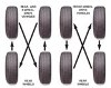
Mga sirs ano sa palagay nyo size ho ng mags/rim ang bagay sa MUX with out sacrificing its riding comfort? Yung sa thread ng eve na mga naka Titanium gusto ng palitan ng stock mags nila into 18" kse matagtag daw?
-
Verified Tsikot Member
- Join Date
- Oct 2015
- Posts
- 155
November 24th, 2015 12:47 PM #11for me, aesthetics nalang ang 18". basta correct tire profile and tire pressure. anyway, matagtag naman talaga ang ladder compared sa crossovers. Originally Posted by mesami
but will be switching to 265/65-17 tire size after (dont know)? years
stock is 255/65-17.
-
Verified Tsikot Member
- Join Date
- Oct 2015
- Posts
- 60
November 24th, 2015 01:59 PM #12Thanks. yung sa Titanium stock yata is 20" gusto I downgrade sa 18" Originally Posted by PJ Sinohin
-
Verified Tsikot Member
- Join Date
- Oct 2015
- Posts
- 155
-
 D' Oiler
- Join Date
- May 2006
- Posts
- 4,347
November 24th, 2015 11:47 AM #14It's doable naman bro... but your trip timing doesn't adds up dahil sa mga pasaway na trike/motorbike pag hapon ang drive mo. Minsan ko lang nakuha ng 2 hours from Magsingal (3 towns more after vigan) to San Fernando and that was in the wee hours in the morning. No trike/motorbike na perwisyo during those times. Yung mga passengers ko na lasing ay hindi nakatulog. Originally Posted by aar0nix
I can't imagine yung sa iyo kung ano ginagawa ng mga passengers mo during your trip hehehe.
Ingat sa pag drive bro and back to regular programming.
Sent from my SM-N9005 using Tapatalk
-
Verified Tsikot Member
- Join Date
- Sep 2015
- Posts
- 85
November 25th, 2015 08:24 AM #15Yep, I have seen Aaron work his magic in EDSA. Originally Posted by aar0nix
 ingat lagi bro
-
Verified Tsikot Member
- Join Date
- Oct 2015
- Posts
- 733
November 24th, 2015 09:30 AM #16Depende sa zoom dapat 50m, pero usually di talaga nasusulat lahat ng street names or minsan nakagitna sa isang street na mahaba. Originally Posted by Civic_Racer
Kailangan familiarize mo din sarili mo sa pag gamit para easy na sa future. So far comparable naman sya sa OSMAnd app sa phone, mas detailed lang OSMAnd. Overall it's quite good naman. At least di ko na kailangan ilagay phone ko sa holder na naka kabit sa dash.
-
Verified Tsikot Member
- Join Date
- May 2006
- Posts
- 391
November 24th, 2015 12:30 PM #17naka auto zoom siya sir.. wala talaga.. hindi lahat may nakalagay na names.. Originally Posted by aar0nix
nasanay lang ako sa garmin na lahat ng street may name.. 4" pa yun.. hehe
nakatanggal na lahat sir.. walang POI Originally Posted by PJ Sinohin
-
 Verified Tsikot Member
- Join Date
- Jan 2013
- Posts
- 1,408
November 24th, 2015 12:42 PM #18Nakapag update na ba kayo ng map sir? Originally Posted by Civic_Racer
-
Verified Tsikot Member
- Join Date
- May 2006
- Posts
- 391
November 24th, 2015 01:35 PM #19Yes sir. Q3 2015 nakalagay sa map. Yun daw yung updated.. Sabi ni winterpine.. Originally Posted by LancerA174A
-
Verified Tsikot Member
- Join Date
- Oct 2015
- Posts
- 733
November 24th, 2015 06:03 PM #20Thanks for the up bro. Ganyan ko din usually kinukuha paakyat ng Baguio. Pag natapos pa yung last segment ng TPLEx I'm sure mabawasan ng 10-15 minutes yan paakyat ng Baguio. Originally Posted by R0TC1V
I think that was an average 8 hours one way for cars. For big bikes 5-6 hours one way up to Pagudpud, some even faster. Nasa records ng BOSS Ironman challenge yung fastest to take the Northern loop. Originally Posted by gundam
My passengers: Originally Posted by Gumusut_Amige
dad - co pilot
2nd row - mom, ate, sis in law, 3 yr old neice
3rd row - kuya plus luggage
My dad spots road-widened shoulders and tells me if it's safe to pass right. Everybody else was sleeping, paminsan checking their phones. Sanayan na lang siguro sa driving style ko. Wala naman nasusuka or nahihilo.
I also use the GPS nav to track overtaking segments, kaya before completing a turn, madalas nasa overtaking mode na ako, yung iba sa harapan ko check pa nila muna yung kalsada kung may parating. Been doing this since I started doing road trips 5 years ago, ang gamit ko pa nga yung OSMAnd app sa phone.
This is my 9th time going up north. I can't say I am an expert but like what I said, madiskarte lang bro. My mu-x is nearing 24k kms since I got it last 12/15/2014. I usually do 30k kms yearly on my daily drive, nagpostpone kasi ako ng Baler and Sagada trips.
Bro turn off mo yung auto zoom. Nakakagulo yun sa navigation.. Personal preference ko lang din. As a guide here's what I usually use: Originally Posted by Civic_Racer
50m - max 30km/h
100m - max 50km/h
200m - max 80km/h
400m - expressway driving
Pag naka auto zoom kasi minsan may hinahanap ka di mo macontrol, babalik ulit sa 50m zoom 😂
Tama din yung suggestion na disable mo yung mga POI. Kung high res sana yung maps hindi ganun ka-crowded ang POI.


 Reply With Quote