

Results 91 to 94 of 94
-

 Tsikot Member Rank 2

- Join Date
- Jul 2006
- Posts
- 1,058
-
 Humpty Dumpty
- Join Date
- Jan 2008
- Posts
- 502
-
 Verified Tsikot Member
- Join Date
- Mar 2007
- Posts
- 5
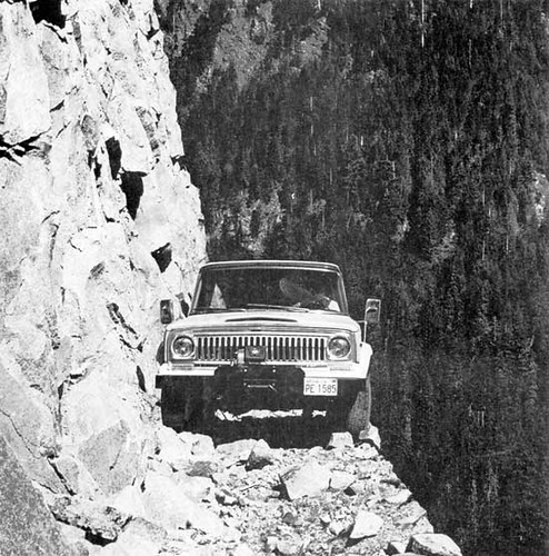
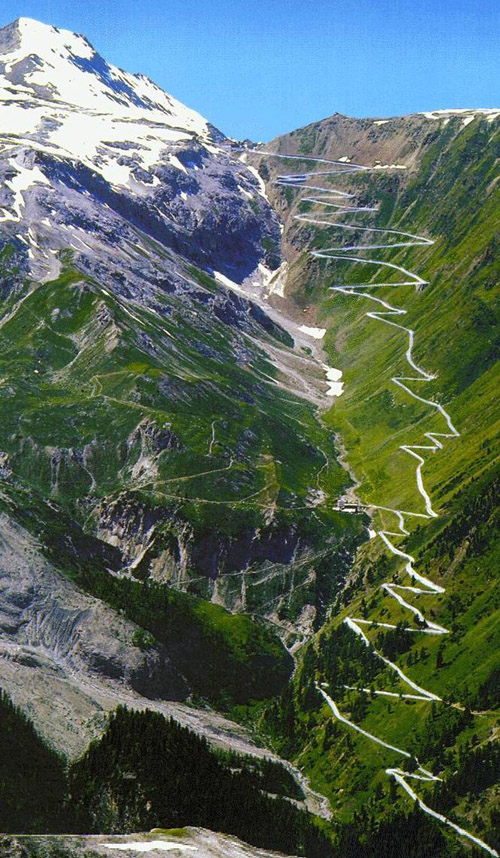
April 3rd, 2008 10:22 PM #93The North Yungas Road (also Grove's Road, Coroico Road, Camino de las Yungas, El Camino de la Muerte, Road of Death, and Death Road) is a 61 to 69 km road (depending on source) leading from La Paz to Coroico, 56 km (35 miles) northeast of La Paz in the Yungas region of Bolivia. It is legendary for its extreme danger and in 1995 the Inter-American Development Bank christened it as the "world's most dangerous road".[1] One estimate is that 200-300 travellers were killed yearly along the road.[1] The road includes crosses marking many of the spots where such vehicles have fallen. Upon leaving La Paz, the road first ascends up to around 5 km, before descending to 330 m (1079 ft), transiting quickly from cool altiplano terrain to rain forest as it winds through very steep hillsides and atop cliffs.
The road was built in the 1930s during the Chaco War by Paraguayan prisoners. It is one of the few routes that connects the Amazon rainforest region of northern Bolivia, or Yungas, to its capital city. Because of the extreme dropoffs up to 2,000 feet, single-lane width, and lack of guardrails, the road is extremely dangerous. Further still, rain and fog can make visibility precarious, the road surface muddy, and loosen rocks from the hillsides above. On July 24, 1983, a bus veered off the Yungas Road and into a canyon, killing more than 100 passengers in what is said to be Bolivia's worst road accident. One of the local road rules specifies that the downhill driver never has the right of way and must move to the outer edge of the road. This forces fast vehicles to stop so that passing can be negotiated safely. Also, vehicles drive on the left, as opposed to the right like the rest of Bolivia. This gives the driver in a left-hand-drive vehicle a better view over their outside wheel, making passing safer.
The danger of the road ironically made it a popular tourist destination starting in the 1990s. Mountain biker enthusiasts, in particular, have made it a favorite destination for downhill biking, since there is a 64 km stretch of continuous downhill riding.
A South Yungas Road (also Chulumani Road) exists that connects La Paz to Chulumani, 64 km (40 miles) east of La Paz, and is considered to be nearly as dangerous as the north road.
-
Tsikoteer
- Join Date
- Jan 2007
- Posts
- 4,459

 Reply With Quote


that may be, but we all got plastic, young and old. we asked the lto guy, "papel ba po, o...
Driver's License Renewal Process?